Our Products
- Home
- Our Products
-
Asphalt/ Bitumen Equipment's
-
Concrete TestingBlaine Air Permeability Cementometer Chlorimeter Compaction Factor Apparatus Compression Testing Machine Concrete Permeability Apparatus Cube Mould Curing Tank Direct Shear Flexural Strength Testing Machine Flow Table High Performance Ultrasonic Pulse Velocity Laboratory Pan Mixer Longitudinal Compressometer Mortar Mixer Mortar Penetrometer Pocket Ultrasonic Tester Rebound Hammer Tile Abrasion
-
Soil TestingAggrameter Aggregate Crushing Value Apparatus Aggregate Impact Value Test Aquaprobe Benkelman Beam Apparatus Buoyancy Balance California Bearing Ratio Apparatus Cone Penetrometer Digital Los Angeles Abrasion Testing Machine Direct Shear (Variable Speed) Le-Chatlier Mould Liquid Limit Pavement Dynamic Cone Penetrometer Plastic Limit Sand Equivalent Value Apparatus Sand Pouring Cylinder Shrinkage Limit Sieves
-
Surveying
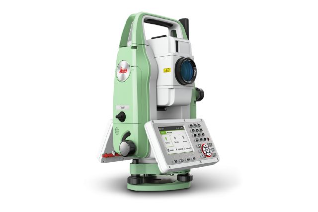
Manual Total Station
- Leica FlexLine TS10 is a high-end manual total station, enabling you to carry out high-demand survey tasks with Leica Captivate software. This way you can participate in the world of 3D by benefiting from 3D views of your measured data.
The TS10 solves daily professional challenges and tasks for growing demands within surveying and mapping, building construction and civil engineering:
- Managing directors of construction departments benefit from minimal downtime of your survey crews to deliver projects under budget and in time.
- Survey managers can rely on the highest product durability in the market, which increases your planning certainty.
- Surveyors work faster by measuring more points per day with less measurement errors and rework
Make : Leica, Switzerland
Specification
- Leica FlexLine: The new generation of manual total stations The new Leica FlexLine series is based on a proven product concept, revolutionising the world of measurement and survey for nearly 200 years. Unlike any other manual total stations in the market, Leica Geosystems manual total stations focus on providing the highest quality, the lowest total cost of ownership and the longest durability in the industry, enabling users to work with purpose-driven solutions for the best performance results.
AutoHeight: Revolutionising instrument height measurement The TS10 offers the world’s first AutoHeight feature as an option. AutoHeight enables the instrument to automatically measure, read and set its instrument height. Prevent time consuming manual effort and eliminate critical errors during the instrument setup when this revolutionary feature uses a laser from the instrument to measure to the ground and automatically passes the measurement to the software.
Leica Captivate software: Comprehensive, intuitive and easy to use The TS10 is equipped with the Leica Captivate field software, a comprehensive application-based software package. This intuitive, familiar software helps you to capture even more points than before. You are also able to tie into the modern 3D dataflow and rigorous quality assurance and control routines.
Service and support: Global, local and best-in-class Now with optional mobile internet access the TS10 connects to the office for a seamless dataflow and to Leica Geosystems trusted global service and support at the touch of a button. With the Active Customer Care program and myWorld customer portal, users have access to latest software updates, service and support as well as to mySecurity. With mySecurity activated, the locking mechanism ensures the device is disabled and can no longer be used.
-
Asphalt/ Bitumen Equipment's
-
Concrete TestingBlaine Air Permeability Cementometer Chlorimeter Compaction Factor Apparatus Compression Testing Machine Concrete Permeability Apparatus Cube Mould Curing Tank Direct Shear Flexural Strength Testing Machine Flow Table High Performance Ultrasonic Pulse Velocity Laboratory Pan Mixer Longitudinal Compressometer Mortar Mixer Mortar Penetrometer Pocket Ultrasonic Tester Rebound Hammer Tile Abrasion
-
Soil TestingAggrameter Aggregate Crushing Value Apparatus Aggregate Impact Value Test Aquaprobe Benkelman Beam Apparatus Buoyancy Balance California Bearing Ratio Apparatus Cone Penetrometer Digital Los Angeles Abrasion Testing Machine Direct Shear (Variable Speed) Le-Chatlier Mould Liquid Limit Pavement Dynamic Cone Penetrometer Plastic Limit Sand Equivalent Value Apparatus Sand Pouring Cylinder Shrinkage Limit Sieves
-
Surveying

